Uttarakhand
Bali Pass Trek
Duration
8 Days
Location
Uttarakhand
Trip Overview
The Bali Pass Trek is one of the most exciting and challenging high-altitude treks in the Garhwal Himalayas of Uttarakhand. Known for its dramatic mountain landscapes, remote trails, and demanding summit climb, this trek is a true adventure for those who want to experience the Himalayas beyond the usual trekking routes. Connecting the beautiful Har Ki Dun Valley with the sacred Yamunotri region, the journey takes you through ancient villages, dense forests, vast alpine meadows, glacial streams, and rugged mountain terrain. Every day brings a new landscape, making the Bali Pass Trek an unforgettable experience for seasoned trekkers and mountain enthusiasts.
Standing at an altitude of approximately 16,200 ft, Bali Pass is the biggest highlight of this expedition. Reaching the pass requires determination, stamina, and a strong sense of adventure, as the trail becomes steeper and more challenging with increasing altitude. However, the reward is extraordinary. From the high mountain pass, trekkers can witness breathtaking views of prominent Himalayan peaks, including Swargarohini, Bandarpoonch, and Kala Nag. The sight of towering snow-covered mountains stretching across the horizon, surrounded by vast valleys and rugged ridgelines, makes the difficult ascent worthwhile. The final approach to the pass is demanding, but it is precisely this challenge that makes reaching the top so rewarding.
The journey begins in the picturesque village of Sankri, a popular base for several Himalayan treks. From here, the trail gradually leads into the remote landscapes of the Govind Pashu Vihar region, passing through charming mountain settlements such as Osla. These villages offer a glimpse into the traditional lifestyle of the Garhwal Himalayas, with their wooden houses, stone pathways, terraced fields, and rich local culture. Life here moves at a slower pace, closely connected to the surrounding mountains and forests. Walking through these settlements allows trekkers to experience a side of the Himalayas that remains untouched by the rush of modern life.
As the trek progresses, the scenery changes beautifully with every stretch of the trail. The initial sections take you through dense forests of pine, oak, and other Himalayan trees, where the sound of flowing water and birdsong accompanies your walk. The trail follows the Supin River through peaceful valleys, crosses rustic wooden bridges, and gradually opens into expansive alpine meadows. Higher up, the greenery gives way to rocky terrain, snow-covered slopes, and glacial landscapes. These changing surroundings make the trek visually diverse and constantly engaging, offering something new at every stage of the journey.
One of the most memorable stops on the Bali Pass Trek is Ruinsara Tal, a pristine high-altitude lake nestled amid dramatic mountain scenery. Surrounded by towering peaks, rocky slopes, and open alpine landscapes, the lake creates a peaceful setting where trekkers can pause and appreciate the quiet beauty of the Himalayas. Its clear waters reflect the surrounding mountains when conditions are favourable, creating a picture-perfect view that feels far removed from the outside world. The campsite near Ruinsara Tal is often one of the most cherished moments of the trek, offering a chance to relax, enjoy the mountain atmosphere, and prepare for the challenging days ahead.
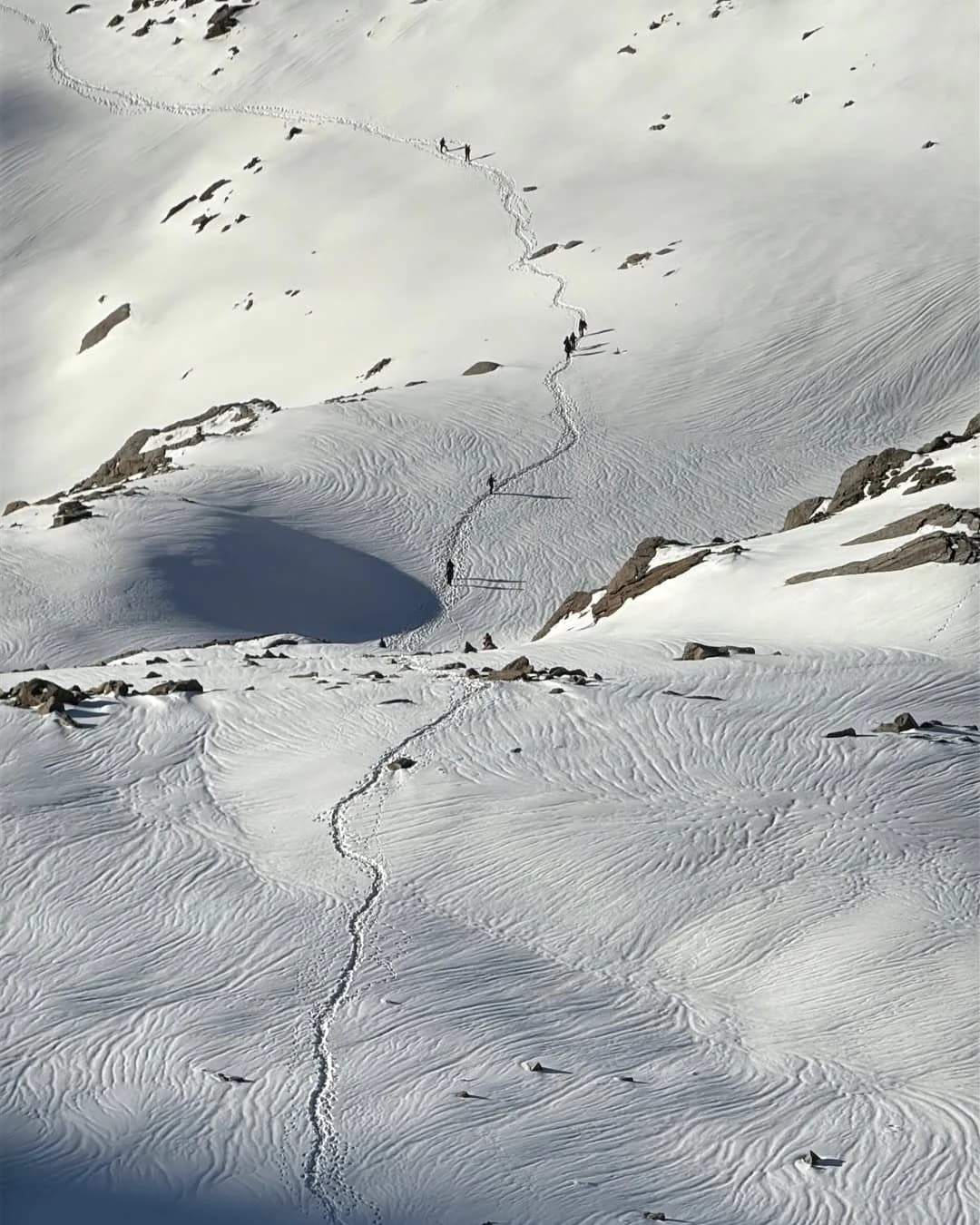
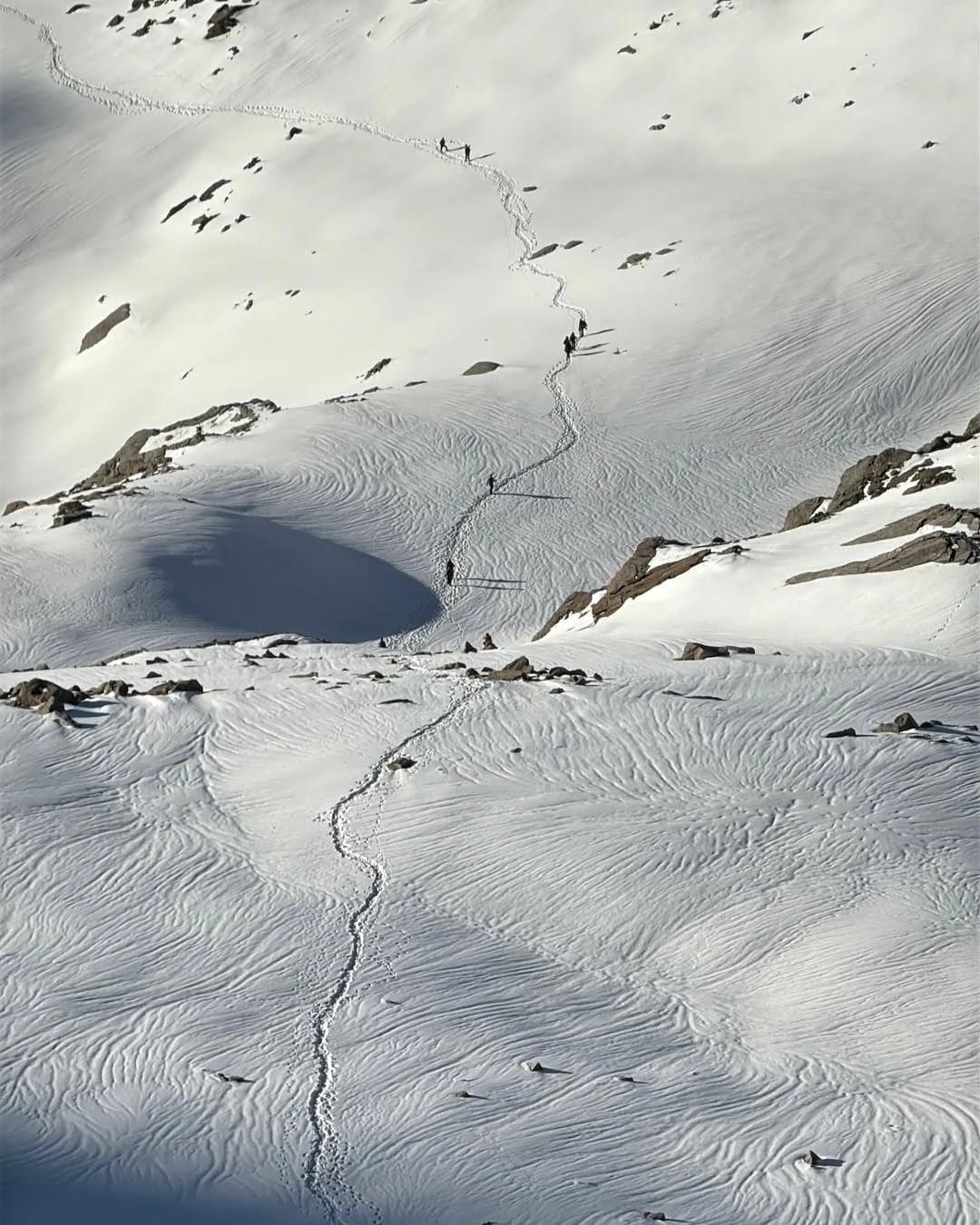
The trek becomes increasingly adventurous as you move towards the higher camps and the base of Bali Pass. The terrain grows more rugged, the air becomes thinner, and the landscape takes on a raw, high-altitude character. Depending on the season and weather conditions, trekkers may encounter snowfields, icy patches, and steep sections that require careful movement and guidance from experienced trek leaders. This part of the journey tests both physical endurance and mental strength. Proper acclimatisation, suitable trekking gear, and a steady pace are essential for handling the demands of the trail safely.
The summit day is the most challenging and exciting part of the expedition. Starting early, trekkers make their way towards Bali Pass across steep mountain slopes and exposed sections where conditions can change quickly. The climb demands focus, patience, and confidence, particularly near the final approach. Reaching the top is a moment of immense satisfaction, as the effort of the previous days comes together in one incredible experience. The panoramic views of the surrounding Himalayan ranges, the vastness of the mountains, and the feeling of standing high above the valleys create memories that stay with you long after the trek is over.
Beyond the summit, the trail descends towards the Yamunotri side of the mountains, taking trekkers through another striking landscape of rocky slopes, alpine terrain, and remote valleys. The descent can be equally demanding, especially on steep or snow-covered sections, and requires careful footing throughout. As the trail gradually leads towards the lower valleys, the surroundings begin to change once again, offering a refreshing contrast to the stark high-altitude terrain. This transition from remote mountain wilderness to the culturally significant Yamunotri region gives the expedition a unique sense of completion.
The Bali Pass Trek is especially beautiful during the summer and post-monsoon trekking seasons, although the exact trail conditions vary depending on weather and snowfall. During the warmer months, alpine meadows become greener, wildflowers add colour to the landscape, and the valleys feel full of life. Later in the season, clearer mountain views and crisp weather can make the high-altitude sections particularly rewarding. However, Bali Pass remains a demanding trek, and snow, strong winds, and sudden weather changes can influence the difficulty of the route.
What makes the Bali Pass Trek truly special is the combination of everything it offers: traditional Himalayan villages, peaceful riverside trails, the serenity of Ruinsara Tal, beautiful alpine meadows, challenging high-altitude terrain, and the thrill of crossing a mountain pass at over 16,000 ft. It is not simply a trek to a viewpoint; it is a complete Himalayan expedition that challenges you physically while allowing you to connect deeply with the natural world.
For experienced trekkers looking for a demanding and rewarding adventure, the Bali Pass Trek is an excellent choice. It requires good physical fitness, prior experience with challenging treks, and the ability to adapt to changing mountain conditions. With the right preparation and a responsible approach, this journey offers an incredible opportunity to explore the wilder side of Uttarakhand and experience the Himalayas in their most dramatic form. From the peaceful shores of Ruinsara Tal to the breathtaking heights of Bali Pass, every step of this expedition brings a new reason to fall in love with the mountains.
Day-wise itinerary
01Arrival in Dehradun and transfer to Sankri
Arrival in Dehradun and transfer to Sankri
Altitude: Approx. 1,950 m / 6,400 ft
Drive Distance: 200 km | 8–10 hrs
Wake up early and assemble at the pick-up point in Dehradun. Begin your scenic drive towards Sankri, the base village for the Bali Pass trek. The journey takes you through beautiful locations like Kempty Falls, Nainbagh, and Mussoorie, offering stunning views throughout. Sankri, located in Uttarkashi within the Govind Wildlife Sanctuary, is a charming Himalayan hamlet surrounded by the Swargarohini peaks and the Greater Himalayan ranges.
Upon arrival, check in to your hotel or homestay and relax. Spend your evening enjoying the peaceful surroundings and mountain views. Dinner and overnight stay at Sankri
02Sankri to Seema via Taluka
Sankri to Seema via Taluka
Altitude: Approx. 2,600 m / 8,500 ft
Trek Distance: 12 km drive + 10–12 km trek | 7–8 hrs
Wake up early in the morning, freshen up, and have breakfast before driving to Taluka (12 km), the starting point of the trek. The scenic drive passes through streams, bamboo, and deodar forests. From Taluka, begin trekking by descending to the riverbed and continue along the Supin River, crossing multiple bridges and passing open meadows and Ghangad village known for its unique wooden architecture.
Continue towards a dhaba and water mill, then trek through forest trails where you may spot the Himalayan Monal. After about an hour, reach Seema campsite, located across the river from Osla village. Check in to the camp, followed by dinner and overnight stay in tents.
03Seema to Rainbasera
Seema to Rainbasera
Altitude: Approx. 3,300 m / 10,800 ft
Trek Distance: 10–12 km | 6–7 hrs
Wake up early in the morning, freshen up, and have breakfast before starting your trek along the Supin River. The trail gradually ascends towards Debshu Bugyal, getting steeper with rocky sections as you enter the Ruinsara Valley. On the way, enjoy beautiful views of Osla village and after a short flat stretch, reach the vast meadows of Debshu Bugyal, offering stunning views of Kala Nag (Black Peak).
From the meadows, descend towards the riverbed on a slippery and stony path, followed by a bridge crossing. A steep climb then leads you to Rainbasera campsite, which has a small hut. Check in to the camp, relax by the riverside in the evening, followed by dinner and overnight stay in tents.
04Rainbasera to Ruinsara Tal
Rainbasera to Ruinsara Tal
Altitude: Approx. 3,500 m / 11,500 ft
Trek Distance: 6–7 km | 4–5 hrs
Wake up early in the morning, freshen up, and have breakfast before starting your trek towards Ruinsara Lake. The trail takes you through streams, meadows, and rugged terrain, making for a scenic 3–4 hour journey. As you get closer, the calm and reflective lake with distant glaciers offers a truly rewarding sight.
The campsite is set between the Supin River and Ruinsara Lake, surrounded by lush meadows and snow-capped peaks like Bandarpoonch, Kala Nag, and White Peak. You can explore the area or visit the nearby Yamunotri temple. Check in to the camp, followed by dinner and overnight stay in tents.
05Ruinsara Tal to Odari
Ruinsara Tal to Odari
Altitude: Approx. 3,500 m / 11,500 ft
Trek Distance: 6–7 km | 4–5 hrs
Wake up early in the morning, freshen up, and have breakfast before starting your trek towards Ruinsara Lake. The trail passes through streams, meadows, and rugged terrain, making for a scenic 3–4 hour walk. As you approach, the calm and reflective lake with distant glaciers creates a truly rewarding experience.
The campsite is beautifully set between the Supin River and Ruinsara Lake, surrounded by lush meadows and snow-capped peaks like Bandarpoonch, Kala Nag, and White Peak. Spend some time exploring the area or visit the nearby Yamunotri temple. Check in to the camp, followed by dinner and overnight stay in tents.
06Odari to Bali pass camp
Odari to Bali pass camp
Altitude: Approx. 3,800 m / 12,500 ft
Trek Distance: 4–5 km | 4–5 hrs
Altitude Gain: 500–600 m / 1,600–2,000 ft
Wake up early in the morning, freshen up, and have breakfast before starting the trek. Today’s trail is short but quite challenging, involving a steep climb on a 60-degree inclined ridge with loose rocks, scree, and stony terrain. The ascent demands careful footing, so maintain a steady pace, take proper breaks, and stay hydrated to avoid AMS.
As you gain altitude, the terrain becomes harsher with thinner air and colder conditions. Temperatures at night can drop below sub-zero, so be well prepared. After this strenuous climb, reach the campsite, check in to your tents, and rest for the night, followed by dinner
07Bali pass camp to Lower Dhamni via Bali Pass
Bali pass camp to Lower Dhamni via Bali Pass
Altitude: 4,950 m / 16,240 ft (Bali Pass)
Trek Distance: 10–12 km | 10–12 hrs
Wake up early in the morning, freshen up, and have a heavy breakfast to prepare for the summit day. Begin your trek towards Bali Pass, which involves a steep climb over snow and rugged terrain. Following your guide, reach the narrow pass after 2–3 hours and witness stunning 360° views of Swargarohini, Bandarpoonch, and the Garhwal peaks along with the Yamunotri valley.
After spending some time at the top, begin your descent towards Upper Dhamni. The trail is steep, narrow, and tricky with snow sections, so move carefully and stay with your group. After a short rest, continue through a relatively easier forest trail to reach Lower Dhamni campsite. Check in to the camp, followed by dinner and overnight stay in tents.
08Lower Dhamni to Jaan ki Chatti and Drive to dehradun
Lower Dhamni to Jaan ki Chatti and Drive to dehradun
Altitude: Approx. 3,300 m to 1,000 m
Trek Distance: 5–6 km trek + drive to Dehradun | 7–8 hrs
Wake up early in the morning and have breakfast before starting the final day of your trek. Today is the easiest, with mostly descents and a few mild ascents along a well-defined and partially paved trail. A short climb of 1–2 hours will take you to Yamunotri.
After reaching, begin your drive back to Dehradun. This marks the end of your trek.
Trip Photos
Inclusions
- ✓Transportation : Tempo traveller or bolero Dehradun to Dehradun, Delhi to Delhi (volvo bus)
- ✓Meals : Breakfast, lunch, snacks, dinner during Trekking
- ✓Stay : Camp and Homestay on respective sharing basis (double & triple sharing)
- ✓Hospitality : All Best Trek leader, guide and Helping staff
- ✓All Sightseeing Mentioned in Itinerary.
- ✓Trek equipment:{Sleeping bag, mattresses, and Utensils
- ✓3 persons all season trekker tent (twin/triple sharing), Kitchen & Dining tent, Toilet tent
- ✓Camping stool
- ✓Medical and support : Basic first aid ⛑
- ✓Trek Completion Certificate
- ✓All forest permit.
Exclusions
- ✕ANYTHING WHICH IS NOT LISTED ABOVE.
- ✕ANY COST INCURRED DUE TO ANY EMERGENCY/CALAMITY.
- ✕ANY CHANGES THAT RESULT IN EXTRA COST.
- ✕Entry ticket for sightseeing.
- ✕all Rental gears
Frequently asked questions
Where is the Bali Pass Trek located?
The Bali Pass Trek is located in the Garhwal Himalayas of Uttarakhand, India. The trail connects the Har Ki Dun Valley with the Yamunotri region, taking trekkers through remote Himalayan villages, alpine meadows, dense forests, and high-altitude mountain terrain.
What is the maximum altitude of the Bali Pass Trek?
The Bali Pass Trek reaches an altitude of approximately 16,200 ft (4,938 m) above sea level. The high-altitude crossing offers spectacular views of the surrounding Himalayan peaks and is one of the most challenging highlights of the expedition.
How difficult is the Bali Pass Trek?
The Bali Pass Trek is considered a difficult trek and is best suited for experienced trekkers. The route includes long trekking days, steep ascents and descents, high-altitude terrain, and potentially snow-covered or exposed sections. Good physical fitness, prior trekking experience, and proper preparation are essential.
What is the best time to do the Bali Pass Trek?
The Bali Pass Trek is generally undertaken during two main trekking windows: May to June and September to October. Summer offers greener landscapes and seasonal wildflowers, while the post-monsoon period can provide clear mountain views. Snow conditions, rainfall, and trail accessibility vary each year, so the final trekking window should be confirmed with the trek operator.
Is the Bali Pass Trek suitable for beginners?
The Bali Pass Trek is not recommended for beginners without prior high-altitude trekking experience. Its demanding terrain, steep sections, and challenging pass crossing require good endurance and confidence on mountain trails. Beginners should first consider easier Himalayan treks and gradually build their fitness and experience.
How fit do I need to be for the Bali Pass Trek?
You should have good cardiovascular endurance, leg strength, and the ability to walk for several hours over uneven terrain. Regular running, brisk walking, stair climbing, and strength training can help you prepare. Ideally, gain experience on moderate or difficult treks before attempting Bali Pass.
What kind of accommodation is available during the trek?
Accommodation generally includes guesthouses or homestays in the base village and camping at designated locations along the trail. Camps are usually arranged in tents, with sleeping bags and essential camping facilities provided according to the trek package. Exact arrangements may vary by operator and itinerary.
Are food and drinking water provided during the Bali Pass Trek?
Organised trekking packages generally include meals during the trekking days, with simple, nutritious food suitable for mountain conditions. Drinking water arrangements vary by operator. Trekkers should carry a reusable water bottle and follow the trek team's guidance on safe drinking water and purification.
Is there mobile network connectivity on the Bali Pass Trek?
Mobile connectivity is generally limited and unreliable along much of the route. You may find network coverage in some villages or lower sections, but it should not be expected at remote campsites or near the pass. Inform your family in advance and be prepared to remain offline for extended periods.
Is the Bali Pass Trek safe?
The trek can be undertaken with appropriate preparation, experienced trek leaders, suitable equipment, and careful attention to weather and altitude. However, it carries inherent risks due to high altitude, steep terrain, snow, and rapidly changing mountain conditions. Following safety instructions, allowing adequate acclimatisation, and being prepared to change or abandon the itinerary when necessary are essential.
What is the age limit for the Bali Pass Trek?
The minimum age and eligibility criteria depend on the trek operator's policies and current safety requirements. Since Bali Pass is a demanding high-altitude trek, participants should meet the operator's fitness standards and have the necessary trekking experience. Confirm the age policy before booking.
Can I do the Bali Pass Trek during my periods?
Yes, you can do the Bali Pass Trek during your periods if you feel physically comfortable and are fit for this challenging trek. Menstruation itself is not a reason to avoid trekking. However, Bali Pass is a difficult, high-altitude trek, so consider your usual symptoms and consult a healthcare professional if you have severe cramps, heavy bleeding, or a history of significant period-related problems.
Will my period make the Bali Pass Trek more difficult?
It depends on your symptoms. Some people experience little discomfort, while others may have cramps, fatigue, headaches, or reduced energy. Since Bali Pass involves steep ascents, long trekking days, and high altitude, pay attention to your body, eat regularly, stay hydrated, and communicate with your trek leader if you need support.