Starting from
₹5,999
per personHimachal Pradesh
Duration
8 Days
Location
Himachal Pradesh
The Pin Bhaba Pass Trek is a spectacular high-altitude expedition in Himachal Pradesh, famous for connecting two contrasting Himalayan landscapes: the lush, green Bhaba Valley in Kinnaur and the rugged, high-altitude desert of Spiti Valley. This dramatic transition in scenery makes the trek one of the most unique and rewarding trekking experiences in the Indian Himalayas.
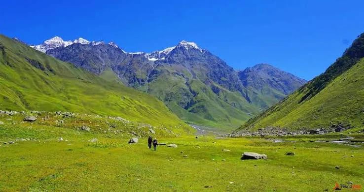
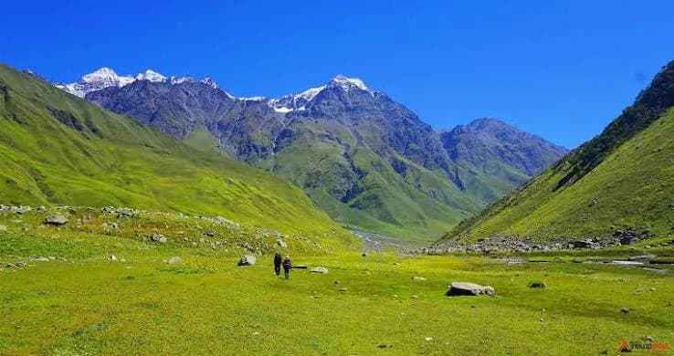
The journey typically begins near Kafnu village in Kinnaur, where the trail winds through dense forests, picturesque villages, rushing streams, and beautiful alpine meadows. As trekkers gain altitude, the landscape gradually opens into expansive grasslands surrounded by towering Himalayan peaks. The route offers incredible opportunities to experience the natural beauty and peaceful atmosphere of the remote mountain valleys.
The trek's defining highlight is crossing Pin Bhaba Pass at approximately 16,105 ft (4,909 m). From the high mountain pass, trekkers witness a remarkable contrast between the green Bhaba Valley and the barren, rugged terrain of Spiti. After crossing the pass, the trail descends into the dramatic Pin Valley, known for its rocky mountains, stark landscapes, and distinctive high-altitude desert scenery.
Unlike many Himalayan treks that remain within a single type of landscape, the Pin Bhaba Pass Trek offers an extraordinary journey through changing ecosystems, from forests and meadows to rocky slopes and cold desert terrain. The route also provides glimpses of traditional Himalayan life and the unique cultural character of Kinnaur and Spiti.
The Pin Bhaba Pass Trek is considered challenging due to its high altitude, steep ascents and descents, remote campsites, and potentially unpredictable weather. It is best suited to trekkers with good physical fitness and prior high-altitude trekking experience. Proper acclimatisation, suitable equipment, and guidance from experienced trek leaders are essential for a safer journey.
For adventure enthusiasts seeking dramatic landscapes, remote Himalayan wilderness, and the thrill of crossing a high mountain pass, the Pin Bhaba Pass Trek offers an unforgettable experience filled with natural beauty and a genuine sense of accomplishment.
Choose your departure location to view days, packages, and batches for that starting point.
Starting Altitude: 7,200 ft (2,200 m)
Ending Altitude: 8,000 ft (2,450 m)
Drive Distance: Approximately 200 km
Drive Duration: 7–8 hours
Accommodation: Guesthouse or homestay
Your Pin Bhaba Pass Trek begins with a scenic drive from Shimla to Kafnu, a peaceful mountain village in the Kinnaur region of Himachal Pradesh. The route passes through winding mountain roads, pine-covered hills, and traditional Himalayan settlements, gradually taking you deeper into the beautiful Sutlej Valley.
As you approach Kafnu, the landscape becomes greener, with forested slopes and views of the surrounding mountains. Upon arrival, check in to your accommodation and meet your trek leader for a briefing about the route, safety instructions, and the days ahead.
Use the evening to organise your trekking essentials, refill your water bottles, and rest well before beginning the trek the next morning.
Starting Altitude: 8,000 ft (2,450 m)
Ending Altitude: 10,700 ft (3,200 m)
Trek Distance: Approximately 11 km
Trek Duration: 7–8 hours
Accommodation: Camping tents
Wake up early, enjoy breakfast, and begin your trek from Kafnu towards Mulling. Today's trail follows the beautiful Bhaba Valley, taking you through dense forests of pine, oak, and silver birch. The sound of the Bhaba River accompanies you along sections of the route, adding to the peaceful atmosphere of the wilderness.
The trail includes gradual ascents, forest paths, and stretches of rocky terrain. You may encounter wooden bridges, mountain streams, and clearings that reveal glimpses of the surrounding Himalayan landscape. As you gain altitude, the dense forest gradually opens into green meadows.
After a long but rewarding trekking day, reach Mulling campsite, a scenic meadow beside the river, surrounded by forested slopes and towering mountains. Settle into your tent, enjoy the fresh mountain air, and spend the evening relaxing beneath the Himalayan sky.
Starting Altitude: 10,700 ft (3,200 m)
Ending Altitude: 11,800 ft (3,600 m)
Trek Distance: Approximately 6 km
Trek Duration: 4–5 hours
Accommodation: Camping tents
After breakfast, begin your trek from Mulling towards Kara. The trail continues through the beautiful Bhaba Valley, crossing rocky sections and open stretches where the surrounding mountains become increasingly prominent.
Today's route is shorter than the previous day, giving you time to appreciate the changing scenery. The landscape gradually transitions from forested terrain to open alpine meadows, with mountain streams and waterfalls adding to the charm of the journey. The final section includes a steeper ascent before you reach Kara.
Kara is one of the most picturesque campsites on the trek, known for its expansive grassy slopes and peaceful mountain setting. Depending on the season, wildflowers may brighten the meadows, while the surrounding peaks create a spectacular backdrop.
After reaching camp, settle into your tent and enjoy the tranquillity of the high mountains. Take photographs, relax, and prepare for the acclimatisation day ahead.
Altitude: Approximately 11,800 ft (3,600 m)
Trekking: Short acclimatisation walks
Accommodation: Camping tents
Today is reserved for acclimatisation at Kara, allowing your body to adjust to the increasing altitude before continuing towards higher camps. Spend the morning enjoying breakfast and taking in the beautiful views of the surrounding meadows and mountain slopes.
Depending on weather conditions and the trek leader's instructions, you may take a short walk around the campsite or visit the nearby Kara Lake. Keep the walk relaxed and avoid unnecessary physical exertion, as proper acclimatisation is essential for a high-altitude trek.
Use the day to hydrate regularly, eat well, and rest. Your trek leader will brief you about the upcoming trail, changing weather conditions, and the importance of following safety instructions during the higher sections.
Spend the evening enjoying the peaceful atmosphere of Kara. As night falls, the remote mountain setting offers an opportunity to experience the quiet beauty of the Himalayas before the trail becomes more rugged.
Starting Altitude: 11,800 ft (3,600 m)
Ending Altitude: 13,700 ft (4,200 m)
Trek Distance: Approximately 5 km
Trek Duration: 4–5 hours
Accommodation: Camping tents
After breakfast, leave Kara and begin the ascent towards Phutsirang, one of the highest campsites on the Pin Bhaba Pass route. Today's trail takes you through increasingly rugged terrain, with rocky paths, loose scree, and exposed mountain sections replacing much of the greenery seen in the lower Bhaba Valley.
As you gain altitude, the landscape becomes more dramatic. Alpine meadows gradually give way to rocky slopes, glacial streams, and patches of snow, depending on the season. The views of the surrounding mountain ridges become increasingly impressive as you approach the higher reaches of the valley.
Although the trekking distance is relatively short, the continuous ascent and altitude make this a demanding day. Walk at a steady pace, take breaks when needed, and follow your trek leader's instructions.
Upon reaching Phutsirang, settle into camp and enjoy the extraordinary mountain surroundings. Spend the evening resting, hydrating, and preparing your gear for the challenging pass-crossing day ahead.
Starting Altitude: 13,700 ft (4,200 m)
Maximum Altitude: Approximately 16,100 ft (4,900 m) at Pin Bhaba Pass
Ending Altitude: 13,400 ft (4,080 m)
Trek Distance: Approximately 17 km
Trek Duration: 11–12 hours
Accommodation: Camping tents
Today is the most challenging and memorable day of the Pin Bhaba Pass Trek. Start early in the morning and begin the demanding ascent from Phutsirang towards Pin Bhaba Pass, the high mountain crossing that connects the lush Bhaba Valley of Kinnaur with the cold desert landscapes of Spiti.
The trail climbs steadily through rocky terrain, loose scree, and snow-covered sections when present. As you gain altitude, the air becomes thinner and the conditions more demanding. Maintain a slow, steady pace, stay close to your group, and follow your trek leader's instructions throughout the ascent.
Upon reaching Pin Bhaba Pass at approximately 16,100 ft, take a moment to appreciate the extraordinary contrast between the two valleys. Behind you lies the greener Bhaba Valley, with its meadows and river systems, while ahead stretches the rugged, barren landscape of Spiti, marked by rocky ridges and dramatic mountain formations.
After spending a short time at the pass, begin the long descent towards Bwaldar. The scenery changes remarkably as you leave the greener Kinnaur side behind and enter the drier terrain of the Pin Valley region.
Reach Bwaldar campsite after a demanding day on the trail. Enjoy a warm meal, rest your tired legs, and celebrate completing one of the most significant milestones of the trek.
Starting Altitude: 13,400 ft (4,080 m)
Altitude at Mudh: Approximately 12,500 ft (3,800 m)
Altitude at Kaza: Approximately 12,200 ft (3,700 m)
Trek Distance: Approximately 12 km
Trek Duration: 5–6 hours
Drive Distance: Approximately 50 km
Drive Duration: 2–3 hours
Accommodation: Guesthouse or homestay
Wake up to the striking landscape of Spiti Valley and enjoy breakfast before beginning your final trekking stretch towards Mudh village. The trail descends through a rugged high-altitude landscape characterised by rocky slopes, red soil, scattered boulders, and wide-open mountain views.
As you continue towards Mudh, the terrain becomes increasingly arid, offering a striking contrast to the green forests and meadows of the Bhaba Valley. The dramatic scenery makes this final walking day a rewarding conclusion to the trekking portion of your journey.
Upon reaching Mudh, take some time to appreciate this remote village in the Pin Valley region, known for its traditional mountain homes, surrounding barren mountains, and distinctive Spitian culture.
After completing the trek, board your vehicle for the drive to Kaza, the main town of Spiti Valley. On arrival, check in to your guesthouse or homestay, freshen up, and enjoy a comfortable evening after several days in the mountains.
Starting Altitude: Approximately 12,200 ft (3,700 m)
Ending Altitude: Approximately 6,700 ft (2,050 m)
Drive Distance: Approximately 200 km
Drive Duration: 9–10 hours
Accommodation: Not included
After breakfast, prepare for the return journey from Kaza to Manali. The drive takes you through the dramatic mountain landscapes of Spiti and across high-altitude roads, offering final glimpses of the rugged Himalayan terrain that made your trek so memorable.
As you travel, watch the landscape gradually change from the dry, rocky mountains of Spiti to the greener valleys and forested slopes closer to Manali. The journey is long and depends on road and weather conditions, so keep your onward travel plans flexible.
Arrive in Manali by evening, marking the end of your Pin Bhaba Pass adventure. You leave with unforgettable memories of alpine meadows, river valleys, remote campsites, and the remarkable transition from the green landscapes of Kinnaur to the cold desert of Spiti.
Please keep an additional buffer day in your travel plan, as weather conditions or road closures can delay the return journey.
The Pin Bhaba Pass Trek is located in Himachal Pradesh and connects the lush Bhaba Valley in Kinnaur with the rugged Pin Valley in Spiti. The trek generally starts from Kafnu and descends towards Mudh village, offering a dramatic transition from green forests and alpine meadows to the barren landscapes of the cold desert.
The trek reaches approximately 16,100 ft (4,900 m) at Pin Bhaba Pass. From this high-altitude crossing, trekkers can experience spectacular mountain scenery and the striking contrast between the green Bhaba Valley and the arid Spiti region.
The Pin Bhaba Pass Trek is considered moderate to difficult. It involves steep ascents, rocky trails, loose scree, possible snow patches, stream crossings, and long trekking hours. The pass-crossing day is particularly demanding, so good physical fitness and prior high-altitude trekking experience are strongly recommended.
The trek is not ideal for unprepared beginners because of its high altitude and strenuous pass-crossing day. Trekkers should build cardiovascular endurance, leg strength, and stamina before attempting it. Previous Himalayan trekking experience is beneficial, and beginners should consult the trek operator about fitness and eligibility requirements.
The main trekking season is generally July to September, when the route is usually accessible and the Bhaba Valley is lush and green. July offers vibrant meadows and seasonal snow patches, August often brings rich greenery and wildflowers, while September can offer clearer mountain views and changing autumn colours. Actual conditions vary each year, and the trek should only be attempted when the operator confirms that the pass is safe.
The trek typically takes 7–9 days, depending on the operator and itinerary. An 8-day plan can include the drive to Kafnu, trekking through Mulling, Kara, and Phutsirang, crossing Pin Bhaba Pass, descending towards Spiti, and travelling onward to Manali. A buffer day is advisable for weather or road delays.
The total trekking distance is approximately 45–55 km, depending on the route and campsite arrangements. The pass-crossing day is usually the longest and most strenuous, involving a steep climb to the pass followed by a lengthy descent into the Pin Valley region.
Accommodation generally includes guesthouse or homestay facilities at the starting point and camping tents at the mountain campsites. In the Spiti region, trekkers may stay in a guesthouse or homestay after completing the trail. Facilities at high-altitude campsites are basic, so prepare for cold nights and limited amenities.
The major highlights include the dense forests and river valleys of Kinnaur, the green meadows of Kara, the high-altitude campsite at Phutsirang, the dramatic crossing of Pin Bhaba Pass, and the rugged landscapes of Spiti. The rapid transition between two very different Himalayan environments makes this trek especially memorable.
Carry sturdy trekking shoes with good grip, layered thermal clothing, a warm insulated jacket, waterproof outerwear, trekking pants, gloves, a woollen cap, sunglasses, sunscreen, a reusable water bottle, a headlamp, personal medication, and basic toiletries. A suitable backpack and warm sleeping arrangements are essential. Your trek operator should provide a detailed gear list, including any equipment needed for snow or stream crossings.
Yes. Acclimatisation is essential because the route reaches approximately 16,100 ft, where oxygen availability is significantly lower than at sea level. Follow the trek leader's pace, stay hydrated, avoid rushing uphill, and report symptoms such as headaches, nausea, dizziness, or unusual breathlessness immediately. Severe or worsening symptoms require prompt medical assessment and descent.
Yes, the route may involve crossing mountain streams and glacier-fed water channels. Water levels can change with snowmelt and weather conditions, making some crossings challenging. Always follow your trek leader's instructions and use designated crossing points; never attempt a crossing independently.
Mobile connectivity is generally limited and unreliable along the remote trekking route. You may have network access in some villages or at the start and end of the trek, but there may be long stretches without service. Inform your family about your itinerary in advance and do not depend on mobile connectivity during the trek.
Yes, keeping at least one buffer day after the planned itinerary is strongly recommended. Heavy rain, snowfall, stream conditions, or road closures can delay the pass crossing or the return journey. Avoid booking tight onward connections immediately after the scheduled trek.