Uttarakhand
Ranthan Kharak Trek
Duration
7 Days
Location
Uttarakhand
Trip Overview
The Ranthan Kharak Trek is a beautiful offbeat Himalayan adventure in Uttarakhand's Kumaon region, offering trekkers an opportunity to discover remote mountain landscapes, peaceful forests, and expansive alpine meadows. Away from the crowds of more popular Himalayan routes, this trek is ideal for travellers looking for tranquillity, natural beauty, and an immersive outdoor experience.
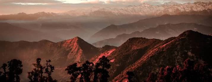
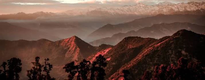
The trail winds through forests of oak, rhododendron, and other Himalayan vegetation, with scenic paths leading towards open grasslands and mountain clearings. As trekkers gradually gain altitude, the dense forest gives way to wider landscapes, revealing spectacular views of the surrounding Himalayan ranges. The changing scenery, fresh mountain air, and quiet wilderness make the journey rewarding for both nature enthusiasts and photography lovers.
One of the main highlights of the Ranthan Kharak Trek is its peaceful meadow landscape. These open high-altitude spaces provide beautiful viewpoints, opportunities for camping, and a chance to experience the serene atmosphere of the Kumaon Himalayas. Depending on the season and weather, trekkers may encounter colourful wildflowers, lush green slopes, misty forests, or snow-covered stretches.
The trek also offers an opportunity to experience the traditional mountain environment of Kumaon, including remote villages, local culture, and the simplicity of life in the Himalayan foothills. Its relatively less-crowded trails make it appealing to travellers seeking an alternative to busier trekking destinations.
The difficulty level depends on the chosen itinerary, elevation gain, trail conditions, and weather. Trekkers should maintain good physical fitness, carry suitable clothing and footwear, and prepare for changing mountain conditions. The best season is generally determined by local weather and trail accessibility, so checking current conditions before departure is recommended.
With its forest trails, peaceful meadows, and beautiful Himalayan surroundings, the Ranthan Kharak Trek offers a refreshing escape into the wilderness of Uttarakhand. It is a rewarding option for trekkers who want to explore the quieter and less-explored side of the Kumaon Himalayas.
Join Us From
Choose your departure location to view days, packages, and batches for that starting point.
Day-wise itinerary
01Kathgodam to Gogina – Drive to the Base Village
Kathgodam to Gogina – Drive to the Base Village
Starting Altitude: Approximately 1,800 ft (550 m)
Ending Altitude: Approximately 6,415 ft (1,955 m)
Drive Distance: Approximately 230–235 km
Drive Duration: 10–11 hours
Accommodation: Homestay or guesthouse
Your Ranthan Kharak Trek begins with an early-morning departure from Kathgodam. Begin the scenic drive into the Kumaon region of Uttarakhand, passing through beautiful mountain towns, winding roads, and lush green valleys.
The route takes you through places such as Almora, Bageshwar, and Kapkot, gradually leading you deeper into the remote Himalayan landscape. As the journey continues, the surroundings become quieter, with forested hills, traditional Kumaoni villages, and glimpses of the mountains accompanying you along the way.
By evening, reach Gogina, a peaceful mountain village that serves as the base for your trekking expedition. Check in to your homestay, meet your trek leader, and attend a briefing about the route, safety guidelines, and preparations for the coming days.
Enjoy a traditional meal and rest well before the trekking adventure begins the next morning.
02Gogina to Namik – Trek Through Forests and Mountain Trails
Gogina to Namik – Trek Through Forests and Mountain Trails
Starting Altitude: Approximately 6,415 ft (1,955 m)
Ending Altitude: Approximately 7,390 ft (2,252 m)
Trek Distance: Approximately 6–6.5 km
Trek Duration: 5–6 hours
Accommodation: Camping tents
Wake up to the refreshing mountain air and enjoy breakfast before beginning your trek from Gogina towards Namik village. Today's trail introduces you to the natural beauty of the Kumaon Himalayas, with a combination of steep descents, river crossings, forest paths, and gradual ascents.
Begin by descending towards the Ramganga River, where the trail leads to a bridge crossing. After crossing the river, start climbing towards Namik through forested slopes and traditional mountain pathways.
As you gain altitude, the surroundings become increasingly scenic, with dense vegetation, small clearings, and glimpses of the Himalayan landscape. The trail requires steady walking, particularly during the ascent towards the village.
Upon reaching Namik, explore the peaceful surroundings of this remote settlement, known for its traditional stone houses and rural Kumaoni lifestyle. Settle into your campsite and enjoy the tranquillity of the mountains.
Spend the evening relaxing, enjoying dinner, and preparing for the next stage of the trek.
03Namik to Bajimanian Kharak – Trek Through Rhododendron Forests
Namik to Bajimanian Kharak – Trek Through Rhododendron Forests
Starting Altitude: Approximately 7,390 ft (2,252 m)
Ending Altitude: Approximately 9,690 ft (2,954 m)
Trek Distance: Approximately 5–5.5 km
Trek Duration: 6–7 hours
Accommodation: Camping tents
After breakfast, begin your trek from Namik towards Bajimanian Kharak, moving deeper into the beautiful forests of the Kumaon Himalayas.
The trail gradually ascends through sections of oak and rhododendron forest, with narrow mountain paths and natural clearings appearing along the route. During the spring season, the rhododendron trees may burst into vibrant shades of red and pink, adding colour to the forest landscape.
As you continue climbing, the dense forest opens into small grassy clearings known locally as kharaks. These open spaces offer a welcome change in scenery and provide opportunities to appreciate the peaceful mountain environment.
Although the trekking distance is relatively short, the steady ascent and uneven terrain require a consistent pace. Take regular breaks and follow your trek leader's instructions throughout the day.
Reach Bajimanian Kharak, a scenic meadow surrounded by forested slopes and mountain views. Settle into your campsite, enjoy a warm meal, and rest well before continuing towards the higher meadows.
04Bajimanian Kharak to Thal Tok – Ascend Towards the High Meadows
Bajimanian Kharak to Thal Tok – Ascend Towards the High Meadows
Starting Altitude: Approximately 9,690 ft (2,954 m)
Ending Altitude: Approximately 11,130 ft (3,392 m)
Trek Distance: Approximately 5 km
Trek Duration: 6–7 hours
Accommodation: Camping tents
Wake up to the beautiful surroundings of Bajimanian Kharak and begin your trek towards Thal Tok after breakfast. Today's trail continues through changing Himalayan landscapes, with forest sections gradually giving way to open meadows and rugged mountain slopes.
As you move higher, the vegetation becomes sparser and the views open up across the surrounding ridgelines. The route includes gradual ascents, narrow ledges, and sections of uneven terrain that require careful footing.
Continue at a steady pace as you approach the higher reaches of the trek. The landscape becomes more expansive, with open grazing grounds and panoramic mountain scenery creating a dramatic setting.
Reach Thal Tok, a high-altitude campsite known for its exposed mountain surroundings and beautiful views of the Himalayan ranges. On clear days, the region offers impressive mountain panoramas, making it a rewarding place to spend the evening.
Settle into camp, enjoy dinner, and prepare for the challenging journey towards Ranthan Top the following day.
05Thal Tok to Parava Thor via Ranthan Top – The Summit Day
Thal Tok to Parava Thor via Ranthan Top – The Summit Day
Starting Altitude: Approximately 11,130 ft (3,392 m)
Maximum Altitude: Approximately 12,887 ft (3,928 m) at Ranthan Top
Ending Altitude: Approximately 9,000 ft (2,743 m)
Trek Distance: Approximately 10 km
Trek Duration: 11–12 hours
Accommodation: Camping tents
Today is the most challenging and rewarding day of your Ranthan Kharak Trek. Start early in the morning and prepare for the ascent towards Ranthan Top, the highest point of the expedition.
The trail climbs through rocky slopes, grassy ridges, and uneven mountain terrain. As you gain altitude, the landscape becomes increasingly dramatic, with wide-open views of the surrounding Himalayan peaks. Depending on the season, you may encounter snow or icy patches along shaded sections of the route.
Upon reaching Ranthan Top at approximately 12,887 ft, take a moment to appreciate the spectacular mountain panorama. On clear days, the views may include prominent Himalayan peaks and ranges such as Nanda Devi, Nanda Kot, Trishul, and Panchachuli.
After spending some time at the summit, begin your descent towards Parava Thor. The route involves a long downhill section across rugged slopes and mountain trails, so walk carefully and follow your trek leader's instructions.
Reach Parava Thor after a demanding day on the trail. Settle into your campsite, enjoy a warm meal, and rest well after completing the major highlight of your trekking expedition.
06Parava Thor to Gogina – Descend Through Forest Trails
Parava Thor to Gogina – Descend Through Forest Trails
Starting Altitude: Approximately 9,000 ft (2,743 m)
Ending Altitude: Approximately 6,415 ft (1,955 m)
Trek Distance: Approximately 9.5–10 km
Trek Duration: 5–6 hours
Accommodation: Homestay or guesthouse
Wake up to the peaceful mountain surroundings and enjoy breakfast before beginning your descent from Parava Thor towards Gogina.
Today's trail takes you through forested sections, mountain slopes, and natural clearings as you gradually return to the lower elevations of the Kumaon region. After the challenging summit day, the descent offers an opportunity to enjoy the scenery at a more relaxed pace while making your way back towards the base village.
As you continue downhill, notice the changing vegetation and the return of denser forest cover. The trail passes through beautiful natural surroundings, offering a final opportunity to appreciate the remote landscapes that make Ranthan Kharak such a special trekking destination.
Upon reaching Gogina, check in to your homestay or guesthouse and freshen up. Spend the evening relaxing, sharing experiences with your fellow trekkers, and celebrating the completion of your mountain adventure.
Enjoy dinner and get some rest before the return journey to Kathgodam the following morning.
07Gogina to Kathgodam – Return Journey
Gogina to Kathgodam – Return Journey
Starting Altitude: Approximately 6,415 ft (1,955 m)
Ending Altitude: Approximately 1,800 ft (550 m)
Drive Distance: Approximately 230–235 km
Drive Duration: 10–11 hours
Accommodation: Not included
After breakfast, check out from your accommodation and begin the return journey from Gogina to Kathgodam.
The drive takes you back through the scenic Kumaon region, passing through winding mountain roads, picturesque villages, and the beautiful valleys around Kapkot, Bageshwar, and Almora.
As you descend towards the plains, watch the landscape gradually change from the rugged Himalayan mountains to the greener lower hills. Enjoy the final views of the Kumaon countryside as you reflect on the memorable experiences of the trek.
Arrive at Kathgodam by evening, marking the end of your Ranthan Kharak Trek expedition.
Please keep your onward travel arrangements flexible, as road conditions, traffic, and weather may affect the arrival time. Booking a late-night train or allowing an additional buffer day is advisable.
Trip Photos
Inclusions
- ✓,
Exclusions
- ✕.
Frequently asked questions
Where is the Ranthan Kharak Trek located?
The Ranthan Kharak Trek is located in the Kumaon region of Uttarakhand, India, near Gogina village in the Bageshwar district. The trail passes through remote Himalayan villages, dense oak and rhododendron forests, open meadows, and scenic mountain ridges.
What is the maximum altitude of the Ranthan Kharak Trek?
The trek reaches approximately 12,900 ft (3,900 m) at Ranthan Top. The altitude may vary slightly across route descriptions and campsite arrangements.
What is the difficulty level of the Ranthan Kharak Trek?
The Ranthan Kharak Trek is generally graded moderate. It includes forest trails, steep ascents, uneven terrain, and a demanding summit day. Good physical fitness and preparation are recommended.
What is the best time to do the Ranthan Kharak Trek?
The best time is generally March to June and mid-September to October, depending on weather and trail conditions. Spring is especially beautiful because rhododendron forests bloom in vibrant shades of red and pink, while autumn often offers clearer mountain views. Avoid planning without checking local conditions during the monsoon and winter.
Can beginners do the Ranthan Kharak Trek?
Fit beginners may undertake the trek with proper preparation, preferably with some prior experience of long walks or Himalayan trails. The summit day can be particularly demanding, so beginners should train adequately and choose an experienced trekking operator.
Why is Ranthan Kharak known as a rhododendron trek?
The trail passes through forests where rhododendrons bloom during spring. The colourful flowers, forest clearings, and remote mountain landscapes make this trek especially attractive to nature lovers and photographers.
Where does the Ranthan Kharak Trek start?
The trek generally starts from Gogina village in Uttarakhand's Kumaon region. Kathgodam is a common pickup and travel point for organised trekking packages.
How can I reach the starting point of the Ranthan Kharak Trek?
By Air: Pantnagar Airport is a regional option. Travellers may also consider other airports based on flight availability and onward transport. By Train: Kathgodam Railway Station is a common railhead for the trek. By Road: From Kathgodam, travel through the Kumaon region towards Almora, Bageshwar, and Gogina. The road journey generally takes around 10–11 hours, depending on road conditions and stops.
Is mobile network connectivity available during the trek?
Mobile connectivity may be available in some villages but is generally unreliable in remote forest sections and higher campsites. Inform family members about your itinerary before beginning the trek.
Is the Ranthan Kharak Trek safe?
The trek can be undertaken with appropriate preparation and experienced guidance. However, steep trails, exposed ridges, changing weather, and remote terrain require caution. Follow the trek leader's instructions, check weather conditions, and avoid attempting the summit in unsafe conditions.