Starting from
₹5,499
per personUttarakhand
Duration
8 Days
Location
Uttarakhand
The Roopkund Trek is a legendary Himalayan adventure in Uttarakhand, renowned for its dramatic mountain scenery, expansive alpine meadows, and the mysterious glacial lake known as Roopkund. Nestled in the Garhwal Himalayas, near the base of the Trishul massif, this trek combines natural beauty, challenging terrain, and a fascinating historical mystery.
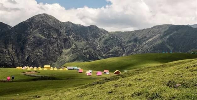
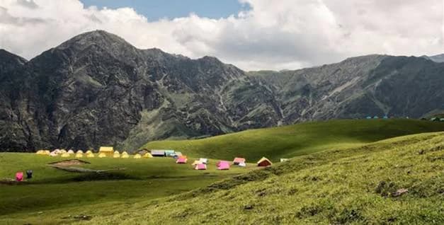
The journey traditionally begins from Lohajung, a picturesque mountain village in Chamoli district. From here, the trail winds through dense forests of oak and rhododendron, traditional Himalayan settlements, and scenic mountain paths. As trekkers gain altitude, the forests gradually give way to expansive grasslands and alpine meadows known as bugyals, including the beautiful Ali Bugyal and Bedni Bugyal.
These meadows are among the trek's most memorable highlights, offering sweeping views of the surrounding Himalayan ranges. During the warmer months, the grasslands turn vibrant green, while clear skies reveal impressive peaks such as Trishul and Nanda Ghunti. Bedni Bugyal also provides a spectacular setting for camping and experiencing the tranquillity of the mountains.
The trek's most famous attraction is Roopkund Lake, situated at approximately 15,750 ft (4,800 m). The small glacial lake is widely known for the human skeletal remains discovered in and around it, which have attracted scientific interest and given the destination its popular name, Skeleton Lake. The area is surrounded by rugged mountain terrain and can experience snow and harsh weather conditions.
The traditional Roopkund route is considered challenging because of its high altitude, steep ascents, unpredictable weather, and demanding terrain. However, trekkers should note that access to Roopkund may be restricted or unavailable under current local regulations, so the exact route and permitted trekking limits must be confirmed before planning or publishing a trip.
The usual trekking season has historically been May to June and September to October, depending on snow conditions and local weather. Spring and early summer may offer snow-covered landscapes, while autumn often brings clearer skies and excellent mountain views.
With its legendary lake, breathtaking bugyals, dense forests, and dramatic Himalayan scenery, the Roopkund Trek remains one of Uttarakhand's most iconic trekking destinations. It is best suited to well-prepared trekkers who want to experience the grandeur and challenge of the high Himalayas.
Starting Location: Rishikesh
Ending Location: Lohajung
Ending Altitude: Approximately 7,800 ft
Drive Distance: Approximately 250 km
Drive Duration: 10–11 hours
Accommodation: Guesthouse or homestay
Your Roopkund Trek begins with an early-morning departure from Rishikesh towards Lohajung, a picturesque mountain village in the Chamoli district of Uttarakhand. The drive takes you through winding Himalayan roads, forested hills, charming settlements, and scenic river valleys.
As the journey progresses, the landscapes gradually transform into the rugged beauty of the Garhwal Himalayas. Enjoy views of the surrounding mountains and river confluences along the way, with occasional stops for refreshments and photographs.
Upon reaching Lohajung, check in to your accommodation and meet your trek leader for a briefing about the upcoming adventure. Use the evening to organise your backpack, check your trekking equipment, and prepare for the journey ahead.
Rest well and get ready to explore the beautiful forests and alpine meadows of the Roopkund trail.
Starting Altitude: Approximately 7,800 ft
Ending Altitude: Approximately 8,000 ft
Trek Distance: Approximately 6–7 km
Trek Duration: 4–5 hours
Accommodation: Homestay or camping, as arranged
After breakfast, begin your first trekking day from Lohajung towards Didna Village. The trail takes you through forested slopes, terraced fields, and peaceful mountain surroundings, offering a gentle introduction to the Roopkund Trek.
The route initially descends towards the Ruan Bagad bridge, crossing a stream before continuing uphill through a forest trail. The ascent after the bridge requires steady effort, so maintain a comfortable pace and take breaks when needed.
As you climb, enjoy the refreshing mountain air and glimpses of the surrounding valleys. The trail gradually leads towards Didna, a traditional Himalayan village where you can experience the peaceful atmosphere of rural Uttarakhand.
Upon arrival, settle into your accommodation and spend the evening relaxing after the day's trek. Prepare for the next day's climb towards Ali Bugyal, one of the most beautiful high-altitude meadows in the region.
Starting Altitude: Approximately 8,000 ft
Ending Altitude: Approximately 11,350 ft
Trek Distance: Approximately 10–11 km
Trek Duration: 6–7 hours
Accommodation: Camping tents
Wake up to the peaceful surroundings of Didna Village, enjoy breakfast, and begin the ascent towards Ali Bugyal. Today's trek takes you through dense forests before opening into vast alpine meadows with breathtaking Himalayan views.
The initial section involves a sustained uphill climb through woodland. As you gain altitude, the trees gradually thin out, revealing wide-open grasslands and panoramic views of the surrounding mountain ranges.
Ali Bugyal is among the most spectacular high-altitude meadows in Uttarakhand. During the trekking season, its rolling green slopes and expansive landscapes create a striking contrast against the snow-covered Himalayan peaks.
Take time to appreciate the scenery as you approach the campsite. The open meadows offer wonderful opportunities for photography, especially when the weather is clear.
After reaching Ali Bugyal, settle into camp, enjoy a warm meal, and rest for the night. The following day takes you across the beautiful Bedni Bugyal meadows towards Patar Nachauni.
Starting Altitude: Approximately 11,350 ft
Ending Altitude: Approximately 12,850 ft
Trek Distance: Approximately 7 km
Trek Duration: 4–5 hours
Accommodation: Camping tents
Begin your morning surrounded by the expansive landscapes of Ali Bugyal. After breakfast, continue towards Patar Nachauni, passing through Bedni Bugyal and Ghora Lotani.
The trail crosses rolling alpine meadows and gradually gains altitude. Bedni Bugyal is a major highlight of the route, known for its beautiful grasslands, mountain views, and the sacred Bedni Kund. On clear days, the surrounding Himalayan peaks provide an impressive backdrop to the landscape.
Continue towards Ghora Lotani, where the trail follows open ridgelines and gentle slopes before descending slightly towards Patar Nachauni.
As you move higher, the air becomes thinner and temperatures may drop, particularly in the evening. Walk at a steady pace, stay hydrated, and follow your trek leader's acclimatisation instructions.
Reach Patar Nachauni and settle into your campsite. Enjoy dinner and get adequate rest before the steeper climb towards Bhagwabasa the following day.
Starting Altitude: Approximately 12,850 ft
Ending Altitude: Approximately 14,150 ft
Trek Distance: Approximately 4–5 km
Trek Duration: 4–5 hours
Accommodation: Camping tents
After an early breakfast, begin the ascent from Patar Nachauni towards Bhagwabasa via Kalu Vinayak. Although the distance is relatively short, the increasing altitude and steep, rocky sections make this a demanding day.
The trail climbs gradually at first before becoming steeper as you approach Kalu Vinayak, a small temple situated along the mountain route. This section offers expansive views of the surrounding ridges and rugged Himalayan terrain.
After crossing the higher section near Kalu Vinayak, continue towards Bhagwabasa. The landscape becomes increasingly rocky and exposed, with cold winds and sudden weather changes possible at this altitude.
Upon reaching Bhagwabasa, settle into camp and allow your body time to acclimatise. Keep yourself warm, drink fluids regularly, and inform your trek leader immediately if you experience a headache, nausea, dizziness, unusual fatigue, or breathlessness at rest.
Get an early night's rest because the next day involves the challenging ascent to Roopkund Lake followed by a long descent.
Starting Altitude: Approximately 14,150 ft
Maximum Altitude: Approximately 15,750 ft
Ending Altitude: Approximately 12,550 ft
Trek Distance: Approximately 14 km
Trek Duration: 10–12 hours
Accommodation: Camping tents
Today is the most demanding and memorable day of the Roopkund Trek. Begin very early, subject to weather and the trek leader's assessment, for the ascent towards Roopkund Lake.
The trail climbs across steep, rocky terrain and may include snow or icy patches depending on the season. The combination of high altitude, cold temperatures, and sustained climbing makes this section physically challenging. Move carefully, maintain a steady pace, and follow the team's instructions throughout.
Roopkund Lake, famously known as Skeleton Lake, lies in a remote glacial basin at approximately 15,750 ft. The lake became widely known after human skeletal remains were discovered around its shores. Its mysterious history, dramatic mountain setting, and surrounding rugged landscape make it one of the most intriguing destinations in the Indian Himalayas.
Spend only the time permitted by your trek leader and local conditions. Access to the lake and any nearby higher viewpoints depends on safety assessments, permissions, weather, and current route regulations.
After the visit, retrace your route towards Bhagwabasa before continuing the descent to Bedni Bugyal, following the approved itinerary. The long descent can be tiring, so pay close attention to your footing and conserve energy.
Reach the campsite by evening, enjoy a warm meal, and rest after this challenging day.
Starting Altitude: Approximately 12,550 ft
Ending Altitude at Wan: Approximately 8,040 ft
Trek Distance: Approximately 12 km
Trek Duration: 6–7 hours
Drive Distance: Approximately 16 km
Drive Duration: Around 45 minutes
Accommodation: Guesthouse or homestay
Wake up to the beautiful mountain scenery of Bedni Bugyal and enjoy your final morning in the high-altitude meadows. After breakfast, begin the descent towards Wan Village through forest trails and picturesque mountain landscapes.
The route passes through Doliya Dhar and Ghaeroli Patal before continuing towards Neel Ganga. Expect sections of steep descent through dense forests, followed by trails leading towards Wan. Take extra care on uneven and potentially slippery sections, particularly after rain.
As you descend, the landscape gradually changes from open alpine grasslands to forested slopes and terraced fields. Enjoy the final views of the Himalayan surroundings as you approach Wan Village.
Upon reaching Wan, meet your vehicle for the short drive back to Lohajung. Check in to your accommodation, freshen up, and relax after completing the trekking circuit.
Spend the evening reflecting on the journey through the forests, meadows, and rugged high-altitude landscapes of the Roopkund region.
Starting Location: Lohajung
Ending Location: Rishikesh
Drive Distance: Approximately 250 km
Drive Duration: 10–11 hours
Accommodation: Not included
Wake up early, enjoy breakfast, and prepare for your return journey from Lohajung to Rishikesh. The drive follows winding Himalayan roads through mountain villages, forested hills, and scenic river valleys.
As you descend towards the foothills, enjoy the changing landscapes and take a final look at the mountains that accompanied you throughout the trek.
The journey can take 10–11 hours or longer depending on road conditions, traffic, and weather. Plan your onward travel with sufficient flexibility and avoid scheduling a tight flight or train connection on the same day.
Upon arrival in Rishikesh, your Roopkund Trek comes to an end. Carry home memories of magnificent alpine meadows, challenging mountain trails, and the remarkable story of the mysterious Skeleton Lake.
The Roopkund Trek is located in the Chamoli district of Uttarakhand, in the Garhwal Himalayas. The route passes through traditional mountain villages, dense forests, vast alpine meadows, and rugged high-altitude terrain before reaching the famous Roopkund Lake.
Roopkund Lake is situated at approximately 15,750 ft (4,800 m) above sea level. The high altitude makes acclimatisation and physical preparation essential.
The Roopkund Trek is considered moderate to difficult. It involves steep ascents, rocky trails, high-altitude camping, and a strenuous summit day that can require 10–12 hours of trekking.
The traditional trekking seasons are May to June and September to October, depending on current access permissions and trail conditions. Summer may offer green meadows and lingering snow, while autumn often brings clearer skies and excellent mountain views.
The classic Roopkund Trek generally takes 8 days, including the drive from Rishikesh to Lohajung, the trekking route, and the return journey.
The classic route covers approximately 53–55 km of trekking, although the exact distance depends on the itinerary and campsite arrangements.
The trek is best suited to physically fit trekkers, preferably with prior trekking experience. Beginners may consider it only if they have trained adequately, can handle long walking days, and are prepared for high-altitude conditions.
Roopkund Lake is popularly known as Skeleton Lake because human skeletal remains have been found around the lake and in its vicinity. The remains have attracted scientific interest, and research indicates that they represent multiple individuals and events rather than one simple historical incident.
The major highlights include Ali Bugyal, Bedni Bugyal, Bedni Kund, Kalu Vinayak Temple, Bhagwabasa campsite, Roopkund Lake, and spectacular views of Himalayan peaks such as Trishul and Nanda Ghunti.
By Air: Jolly Grant Airport in Dehradun is a convenient airport for reaching the region. Continue by road to Rishikesh and onward to Lohajung. By Train: Rishikesh or Haridwar can be used as railway access points, depending on your train connection. Continue to Lohajung by road. By Road: Lohajung can be reached from Rishikesh via the Garhwal region, with the journey generally taking around 10–11 hours depending on road and weather conditions.